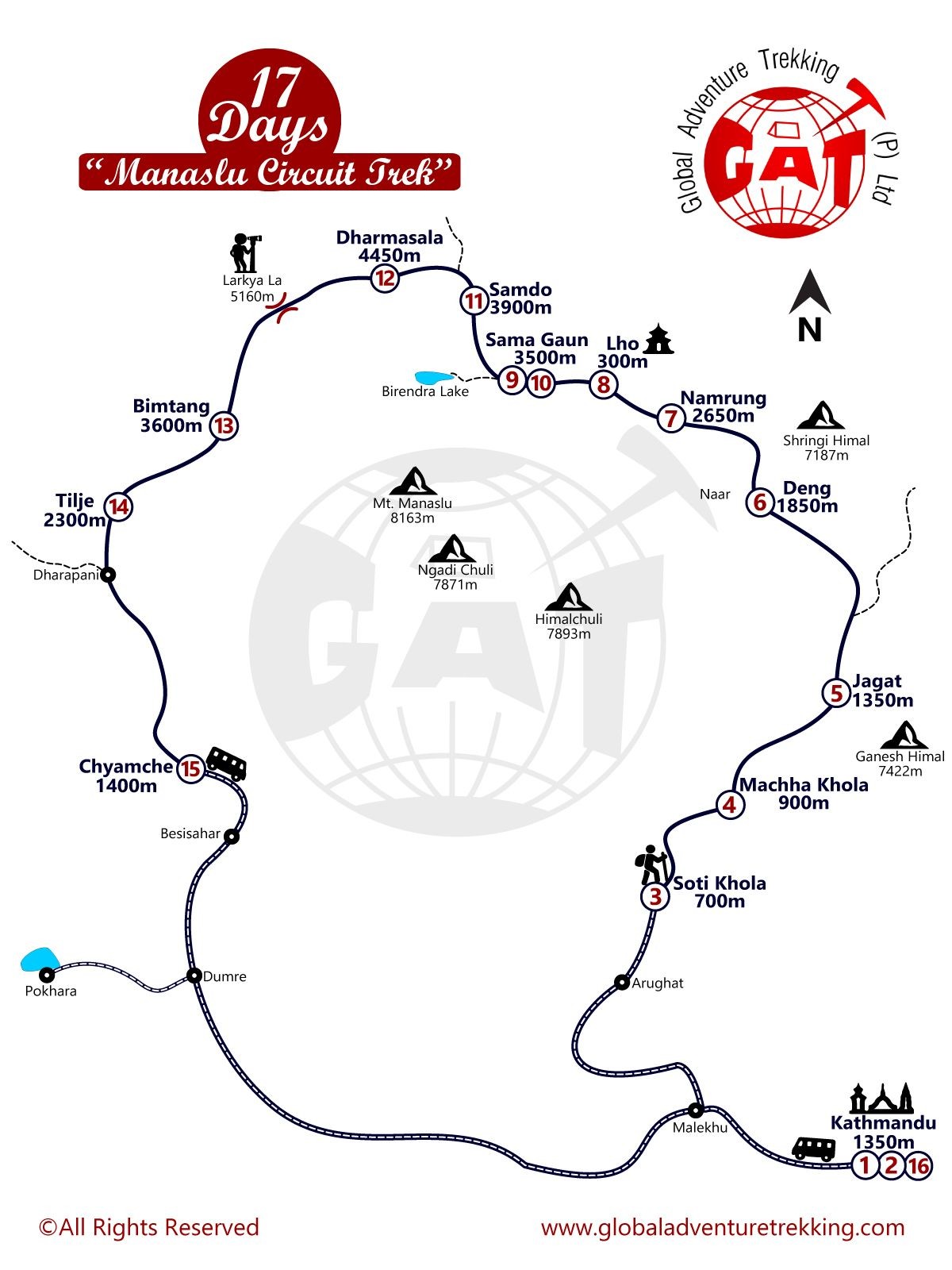
Manaslu Circuit Trek Map:
Manaslu Circuit Trek ranges the destination from the altitude of 700 m to as high as 5106m. The route map of Manaslu trek which include Kathmandu (1350m), Soti Khola (700m), Machha Khola (900m), Jagat (1350m), Deng (1850m), Namrung (2650m), Lho (3150m), Samagaun (3500m), Samdo (3700m), Dharmashala (4450m), Larkya La Pass (5106m), Bhimtang (3600m), Tilje (2300m), Dharapani (1900m) and Chyamche (1400m).